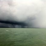
June Rainfall Nearly Double District-wide Average.
Water Conservation Areas received more than twice their monthly average rainfall, leading SFWMD, DEP, and USACE to take measures to address high water emergency.

June Rainfall Nearly Double District-wide Average.
The South Florida Water Management District issued the following news release.
‘These two extremes illustrate the system’s unpredictability and showcase the alertness required to take necessary actions when drought concerns turn to flooding realities,’ said SFWMD Governing Board Chairman Dan O’Keefe. ‘This is the nature of water management in South Florida and this is why we work 24/7 to protect families, businesses and the environment.’
The District-wide average rainfall for June was nearly 15 inches or about 181 percent of average. The three water conservation areas, critical links in the system, which convey water south from Lake Okeechobee to Everglades National Park, received the heaviest rainfall. Water Conservation Areas 1 and 2 received 18.49 inches or 246 percent of average. Water Conservation Area 3 received 18.74 inches or 219 percent of average.
 Most of these heavy rains fell in the first two weeks of June.
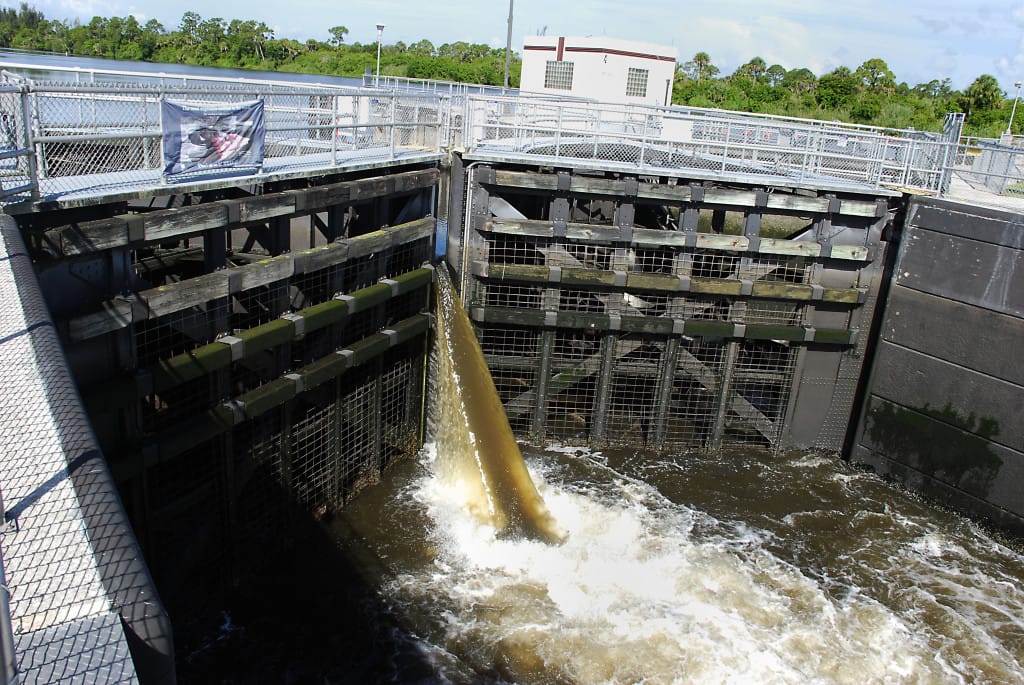
- Implementing emergency deviations with the approval of the U.S. Army Corps of Engineers to send more water to tide using the S-197 structure in Miami-Dade County, as well as increasing pumping at the S-332D pump station and allowing the use of the S-343A and B and S-344 structures to move more water out of the conservation areas to Everglades National Park and the Big Cypress National Preserve.
- Maximizing discharges from Water Conservation Area 1 to tide through the Hillsboro Canal in Palm Beach County.
- Maximizing discharges from Water Conservation Area 2A to tide through the C-14 Canal in Broward County.
- Maximizing discharges from Water Conservation Area 2A to tide through the North New River Canal in Broward County.
- Maximizing discharges from Water Conservation Area 3A to tide through the Miami Canal in Dade County.
-
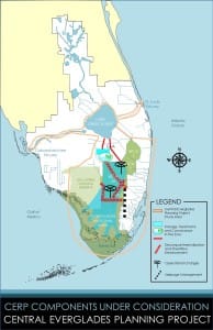
Map CERP Central Everglades Planning Project.
Maximizing discharges through the S-333 structure at the southern end of Water Conservation Area 3A to Everglades National Park.
- Releasing water through the S-334 structure to the South Dade Conveyance System where it is being sent to tide.
- Using gravity to send water that would otherwise be pumped into Water Conservation Area 3A to tide. The S-13 Pump Station is also being used to pump water during high tide when it would be impossible to use gravity.
- Moving water from the A-1 Flow Equalization Basin in Palm Beach County to Lake Okeechobee through the North New River Canal.
- Moving water from Stormwater Treatment Area 2 to Lake Okeechobee through the North New River Canal.
- Moving water from Water Conservation Area 1 in Palm Beach County to tide through the C-51 Canal.
- Moving water from Water Conservation Area 1 in Palm Beach County to Lake Okeechobee through the L-8 Canal.
- Maximizing flows out of Water Conservation Area 3A through the S-344, S-343A, and 343B structures.
- Constraints removed from S-199, S-200, and S-737 structures, moving water into Everglades National Park from the C-111 Canal.
- Performing daily inspections along the stretch of the L-37 Levee, bordering Water Conservation Area 3A in Broward County between Interstate 75 and Griffin Road, to ensure its integrity.