Red Tide Report: No Red Tide Near Sanibel & Captiva, 10-4-14
The latest FWC statewide red tide report came out yesterday.
There are no red tide conditions near Sanibel & Captiva.
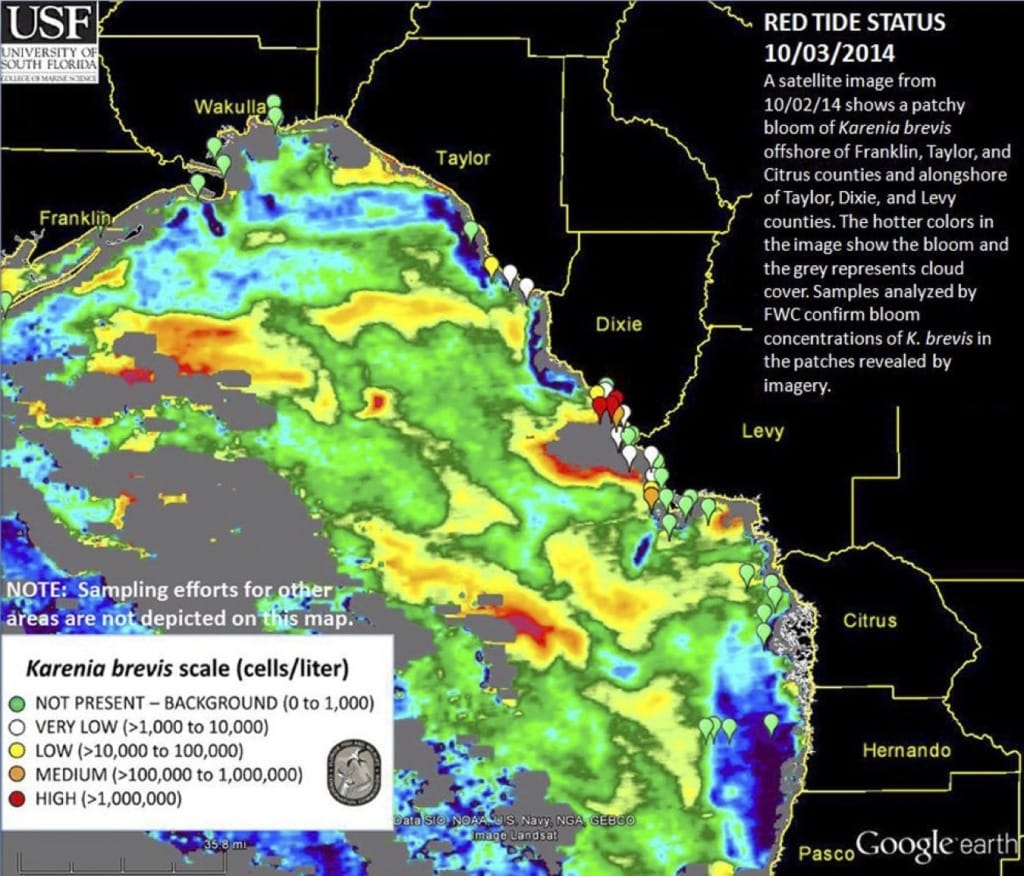
FWC Red Tide Status Report (October 3, 2014)
“A patchy bloom of Karenia brevis, the Florida red tide organism, continues in the northeast Gulf of Mexico. Satellite images from the Optical Oceanography Laboratory at the University of South Florida show patches offshore of Franklin, Wakulla, Taylor, and Citrus counties and alongshore of Taylor, Dixie, and Levy counties.
Concentrations of the red tide organism in these areas range from background to high. Additional samples analyzed throughout Florida this week did not contain Karenia brevis.”
For more information, please see yesterday’s 9-26-14 Florida Fish & Wildlife Conservation Commission red tide report.